Background
In recent years, Forest Department Sarawak has achieved excellence in the management and conservation of tropical forests. Through various initiatives, it manages and develops forest resources for social-economic and environmental responsibility. To date Sarawak has a total landmass of 12.4 million hectares, with 62 percent of it covered in forest cover, and significant efforts are being made to safeguard the state’s valuable natural resources. Managing such resources poses numerous challenges because of the geographical factors as mountainous terrains, numerous rivers and tributaries and in most cases, the poor conditions of the roads make access a nightmare.
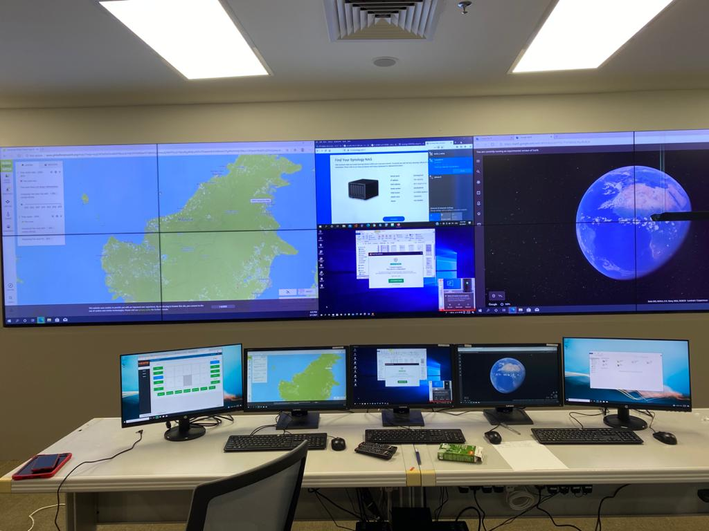
The war room (Figure 1), a centralised command and control unit for the collection of on-the-field data, is the Department’s heart and lifeline. These tactical data that describes the land use activities within the targeted areas are quickly returned for analysis, allowing for a more rapid course of action by the enforcement team. The hyper-eye in the sky, which incorporates hyperspectral sensing technology provides a more efficient method of gathering information for intelligence by the departments enforcement division and this is integrated to a web based geospatial analysis tool that provides an up-to-date performance metrics and visualisation.

The War-Room functioning as a centralized Command and Control facility to disseminate tactical information for the forest enforcement team
This has provided the department with the capacity to detect and map illegal logging activities in the forested areas of the State with its vast geographical landmarks. Such technology aids the department in providing comprehensive monitoring and surveillance of Totally Protected Areas (TPA’s) and Permanent Forests (PFEs) in the State, as well as effective information and resource sharing among state enforcement agencies and the ministry-MUDeNR,
The Way Forward
With the continued support from the federal government through the Ministry of Energy and Natural Resource (KeTSA), the Department goes one step ahead with the development of a multi-purpose hyperspectral sensing system based on the DA42-MPP aerial platform Figure 2). The DA42-MPP platform carries mission specific sensors that are configured for either surveillance or mapping sorties. As a development project approved under the 11th Malaysia Plan, the project showcases the collaboration between the federal and state government in the sharing of assets and expertise for application in natural resource monitoring and management in the country.

The DA42-MPP multi-purpose hyperspectral sensing system for aerial surveillance and mapping missions in the country
Apart from forest management, the aircraft could be used and extended for other forestry applications such as monitoring pest and disease in forest plantation (Figure 3), aerial volume estimation of planted tree species, landscape management of public park, soil mapping, wildfire assessment, marine application and disaster management.

The image on the left is derived from a hyperspectral sensor over a planted forest site which shows the pre-visual symptoms (light colored crowns) of trees that were infected by Ceratosystis sp. in contrast to the image on the right that was taken over the same area using a drone-based camera where only trees showing visible symptoms (late chlorosis) are detected.
The post Technological Efforts: Forest Management in Sarawak, Enforcement and Hyperspectral Technology appeared first on Borneo Post Online.


